Toulouse
- France: Canal du Midi
Figure 37: Original image (SPOT P)
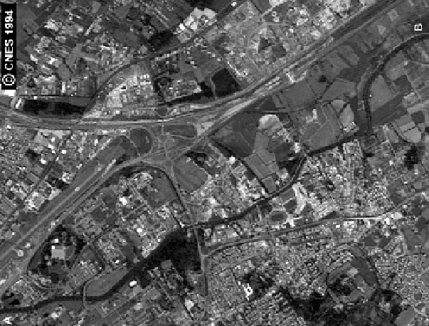 |
Figure 38: Original image (SPOT XS3)
 |
Images ( Figure 37) and ( Figure 38)
show a portion of the CANAL du MIDI between A and B. The north region is
an urban zone, and the canal is occluded by vegetal cover, mainly noticeable
on channel XS3. The database available has a maximum error of 45 meters
(6 pixels). To increase the difficulty original vectors have been modified
to have a maximum error of 60 meters (8 pixels); we use a search area of
10 pixels large.
Figure 39 shows the result of dynamic
programming on valleys extracted from SPOT P. Two errors may be noticed
in A and C, and a very important one in B. Figure 40
shows the dynamic programming on valleys extracted from SPOT XS3, there
are two important errors A and B in the occluded upper part. As we used
two different images to perform the extractions, we use the intermediate
fusion to combine the results. The dynamic programming on the intermediate
fusion ( Figure 41) is nicer; one can
see only one small error in C, and noise effect in the occluded upper part.
Figure 39: ISEF valleys (Channel P)
 |
Figure 40: ISEF valleys (Channel XS3)
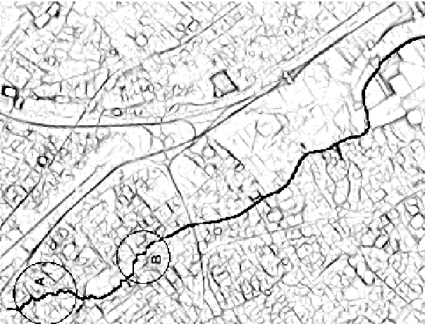 |
Figure 41: Intermediate fusion
 |
The snake ( Figure 43) fits the real
position of the CANAL du MIDI, regarding to original vectors ( Figure 42),
error C and the noise effect have been smoothed
Figure 42: Vectors from Data Base
 |
Figure 43: Snake result
 |


IRIT-UPS